
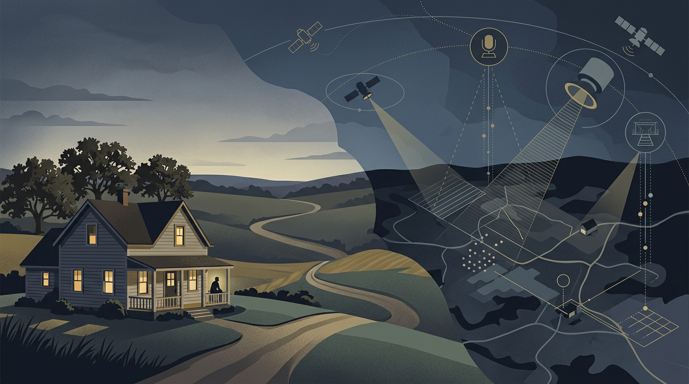
Imagine a government agency purchasing several years of commercially available satellite imagery covering thousands of rural properties. The agency uses artificial intelligence to reconstruct changes to those properties over time, identify potentially unlawful activity and flag particular locations for investigation. Government employees review only the results selected by the algorithm.
Has the government conducted a search under the Fourth Amendment?
This hypothetical formed the basis of a recent discussion in the University of Mississippi’s Remote Sensing Law course. The students approached the question from different perspectives, but their arguments revealed a fundamental tension in American constitutional law. Courts have long permitted certain forms of aerial observation, yet modern remote sensing systems can do considerably more than capture a photograph of what is visible from above.
The legal challenge is determining whether thousands of individually permissible observations become something constitutionally different when artificial intelligence transforms them into a detailed history of private property.
The Law Was Built Around the Observer
Traditional Fourth Amendment analysis asks whether government conduct intrudes upon a reasonable expectation of privacy or otherwise constitutes a search under established constitutional principles. In the context of aerial observation, the Supreme Court has generally been reluctant to recognize privacy interests in features of property visible from lawful public vantage points.
In California v. Ciraolo (1986), police officers flew over a fenced backyard and observed marijuana plants. The Supreme Court held that the observation did not constitute a Fourth Amendment search because the plants were visible to an observer flying in lawful navigable airspace. In Florida v. Riley (1989), the Court similarly rejected a Fourth Amendment challenge involving aerial observation of a greenhouse, although the Justices disagreed about the significance of the aircraft’s altitude and the regularity of public flights at that height.
In Dow Chemical Co. v. United States (1986), the Court permitted the Environmental Protection Agency to use aerial photography to inspect an industrial facility. The decision recognized that sophisticated imaging technology might raise different constitutional concerns, but the photographs at issue did not reveal intimate details of private life.
These cases offer considerable support for government use of commercially available satellite imagery. If a property feature is exposed to lawful observation from above, purchasing an image of that feature does not automatically transform the observation into a constitutional search.
The open-fields doctrine reinforces this conclusion for areas outside the home and its curtilage. Yet rural property is not necessarily an open field in its entirety. A rural parcel may contain a residence, private outdoor living areas and other spaces entitled to substantially greater constitutional protection.
The difficulty is that none of these distinctions fully addresses what happens when the government stops looking at individual photographs and starts reconstructing years of activity.
When the Whole Reveals More Than the Parts
A single satellite image might show a new structure, a cleared field or vehicles parked beside a building. A series of images collected over several years can reveal when the structure appeared, how frequently vehicles visited, whether activities followed recurring patterns and how a property was used over time.
Artificial intelligence makes this analysis possible across thousands of properties simultaneously. What might once have required months of human investigation can now be performed automatically, with government employees examining only the locations selected for further attention.
This changes the nature of the surveillance.
In United States v. Jones (2012), the Supreme Court addressed prolonged GPS tracking of a vehicle. Although the majority resolved the case on the basis of physical trespass, concurring opinions expressed concern that long-term monitoring could reveal patterns of behavior far beyond what individual observations disclose.
The Court developed related concerns in Carpenter v. United States (2018), holding that government acquisition of historical cell-site location information constituted a Fourth Amendment search. The records allowed investigators to reconstruct a detailed account of an individual’s movements, even though the information was held by a third party.
Neither case establishes that aggregating satellite imagery necessarily constitutes a search. GPS tracking and cell-site records can reveal an individual’s movements in ways that ordinary imagery of land may not. The distinction between monitoring a person’s location and documenting visible changes to property remains legally significant.
Nevertheless, these decisions challenge the assumption that information loses all constitutional protection merely because individual observations were lawful or the underlying records were commercially available.
The question is no longer simply what a satellite could see on a particular day. It is what the government can discover by connecting observations across years.
Can an Algorithm Conduct a Search?
One of the most interesting issues raised by the class was identifying precisely when the Fourth Amendment might become relevant.
The surveillance process can be divided into several stages: a commercial operator collects imagery, a government agency purchases the data, an AI system analyzes it, and government employees review selected results.
The initial collection ordinarily presents the weakest Fourth Amendment argument when a private satellite operator independently acquires imagery for commercial purposes. The analysis could change if the company were acting as an instrument or agent of the government, but commercial activity does not automatically become government conduct simply because a public agency later purchases the resulting product.
The government’s purchase of the imagery raises a different question. Accessing commercially available information is not necessarily a search, although Carpenter demonstrates that third-party possession alone does not settle the constitutional analysis.
The more difficult stage is automated analysis.
When an AI system reconstructs years of activity and identifies properties for investigation, it is performing the work that a government investigator might otherwise perform by examining thousands of images. The algorithm does not merely store information. It compares observations, identifies patterns and assigns significance to what it finds.
Should the constitutional analysis depend on whether a human employee personally examines the underlying images?
Some students argued that the strongest privacy concern arises when the government deploys the AI system, because the automated analysis itself creates information that was not readily available from individual observations. Others considered the moment when flagged results reach government employees more significant, reasoning that the government then begins to focus its investigative attention on particular properties.
Both positions expose a potential weakness in a legal framework that places too much emphasis on human observation. If an algorithm can conduct the substantive analysis before any employee reviews the results, waiting for human involvement may overlook the most consequential stage of the surveillance.
At the same time, the mere use of AI should not automatically transform lawful government activity into a search. A system identifying visible changes in agricultural land may present different privacy concerns from one reconstructing patterns of activity around a residence. What the technology reveals, rather than the presence of an algorithm alone, remains central to the analysis.
Does It Change Anything If the Government Is Enforcing Civil Regulations?
The hypothetical deliberately leaves the nature of the suspected violations unspecified. That omission creates another important question: does it make a difference whether the government is investigating criminal activity, zoning violations, environmental regulations or property taxes?
Government agencies routinely collect information to administer regulatory programs. Satellite imagery can help identify unauthorized construction, monitor environmental conditions and assess land use. These activities serve legitimate public purposes and do not necessarily resemble traditional criminal investigations.
But the Fourth Amendment is not limited to criminal law enforcement.
In Camara v. Municipal Court (1967) and See v. City of Seattle (1967), the Supreme Court recognized Fourth Amendment protections in the context of administrative inspections. The government’s regulatory purpose can affect the standards governing a search, but it does not categorically remove government conduct from constitutional scrutiny.
This distinction becomes especially important when automated monitoring leads to physical inspections or enforcement proceedings. An AI-generated flag may provide a reason to investigate, but it does not necessarily establish probable cause or independently authorize entry onto constitutionally protected property.
There is also a practical complication. In Long Lake Township v. Maxon, litigation involving drone photography used for zoning enforcement raised questions about both Fourth Amendment protections and the availability of the exclusionary rule in civil enforcement proceedings. Even when government surveillance is constitutionally questionable, the remedy may depend on the type of proceeding and the jurisdiction.
The constitutional inquiry and the consequences of a violation are not always the same question.
The Problem of Getting It Wrong
The class also identified a concern that extends beyond whether the initial surveillance constitutes a search: what happens when the algorithm makes a mistake?
Satellite imagery does not always tell the whole story. Resolution, viewing angle, atmospheric conditions and the timing of image acquisition can affect what appears in a photograph. An object that looks suspicious from orbit may be entirely ordinary when examined on the ground.
Artificial intelligence adds another layer of uncertainty. An algorithm trained to identify particular patterns may misclassify structures, overlook relevant context or flag lawful activities as potential violations.
These errors become more consequential when government agencies rely on automated findings to decide which properties deserve additional investigation.
Human review can reduce some risks, but its effectiveness depends on what reviewers actually examine. An employee presented with an algorithmic conclusion rather than the underlying imagery may have limited ability to assess whether the flag is justified.
This raises questions about transparency, data retention, interagency sharing and the ability of affected individuals to challenge the government’s conclusions. These are not all Fourth Amendment questions. They may also implicate administrative procedure, evidentiary standards, due process and the design of government oversight systems.
The distinction is important. A surveillance practice may be constitutional and still be poorly designed, unfair or unreliable. Conversely, procedural safeguards cannot necessarily cure an underlying unconstitutional search.
A New Kind of Government Observation
Remote sensing has always challenged traditional ideas about privacy. Satellites observe without entering national airspace, commercial operators collect enormous quantities of information, and government agencies can purchase data that they did not collect themselves.
Artificial intelligence changes the equation again. It allows government agencies to search across time, identify patterns and direct investigative attention on a scale that would have been difficult to imagine when the Supreme Court decided its foundational aerial observation cases.
The Fourth Amendment does not prohibit every government use of powerful technology, and existing doctrine provides substantial room for observation of property exposed to public view. But neither does commercial availability necessarily resolve the constitutional questions created by persistent, automated surveillance.
The most important distinction may ultimately be between observing what is visible and using technology to discover what could not realistically have been learned through ordinary observation.
As remote sensing and AI become increasingly integrated into government decision-making, courts will face a difficult question: At what point does the ability to see everything become the power to search everyone?
Kathleen Brett, Ashley Burroughs, Joseph Clark, Kellie Jenkins, Austin Kwikkel, Hugh Londrey, Ashley Miller, Peyton Reed, Craig Scheer, Michael Stiller, Manzurakhon Talipova
Leave a Reply